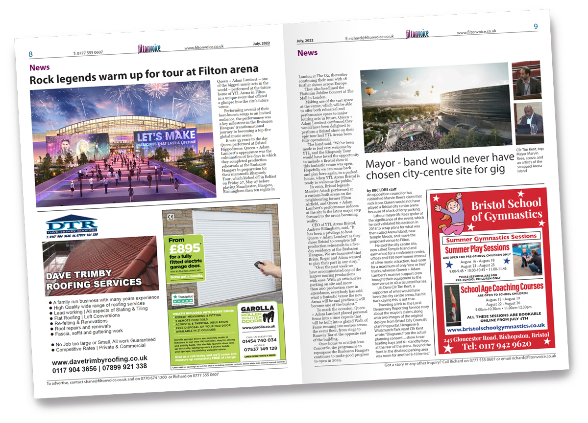

‘VAST swathes’ of countryside east of the Avon Ring Road will disappear under housing in a new blueprint for 20,000 new homes, opposition councillors claim.
Conservative group leader Sam Bromiley told a South Gloucestershire Council meeting that the green belt next to the A4174 would be “lost pretty much entirely” and that Shortwood, between Emersons Green and Pucklechurch, could end up merging with Siston and Warmley to the south.
The council’s new 15-year Local Plan will be put out to public consultation from December 4, with detailed maps of all the sites which could potentially be used to meet the area’s need for new housing and employment development.
The draft document outlining the plan was approved at a cabinet meeting on November 13.
Although it contained no maps, it included a list of possible development sites and the number of houses that could potentially be built there, including:
• Cossham Street, Mangotsfield (195 homes)
• Bristol Uniforms factory, Staple Hill (58)
• Downend Clinic (10)
• South of Shortwood Hill, Mangotsfield (50)
• Three sites at Shortwood with a total of 1,295 homes – one with 950 homes, employment facilities, a school and park & ride, one with 280 homes and one with 65 homes.
• North of Lyde Green – 750 homes plus employment, primary, local centre and park & ride.
The Cossham St site is likely to be a field owned by developer Taylor Wimpey between Cossham Street and Rodway Hill Road: an application for 180 new homes there was rejected in 2009.
The council says it has to find new sites for 9,260 new homes between 2025 and 2040 to help meet a target of 20,490 homes in the district – they will be added to 8,080 which already have planning permission and 3,150 on sites for under 10 homes not included in the plan.
The authority’s Lib Dem/Labour administration defended allocating open fields for housing and insisted the impact on communities and land that currently had protected status was “unavoidable”.
Cabinet approved the document outlining where houses, jobs and infrastructure will go between 2025 and 2040, which will be sent out for public consultation next month.
Cllr Bromiley (Parkwall & Warmley) told the meeting: “The draft Local Plan proposes thousands of new homes on greenfield land – a lot of this looks like it will be situated in the green belt.”
He said it was “embarrassing” to have to tell people who were “losing sleep that houses could be built or may not be built around their homes” that no maps were available yet.
Lib Dem cabinet member for planning, Chris Willmore, said: “We have taken every single brownfield site that the previous administration had identified and allocated them.
“But we’ve gone further and we’ve been hunting for more. We are reviewing all of the council’s property portfolio to see if there is any brownfield land in there.
“It’s easy to make a promise that you’re not going to touch the green belt until you do the sums and you discover they simply don’t add up.”
The draft Local Plan can be found online at
tinyurl.com/429rm47c.
Meeting report by Adam Postans, Local Democracy Reporting Service